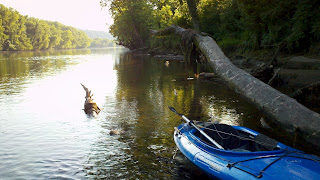
According to Wikipedia a Blueway is "a water path or trail that is developed with launch points, camping locations and points of interest for canoeists, paddle boarders and kayakers. Blueways are typically developed by state, county or local municipalities to encourage recreation, ecological education and preservation of wildlife resources. Blueways are usually developed in quiet still water linear bodies of water that are absent of motor powered boats."
We have a lot of Blueways in the Upper East TN area. I am going to be hitting some of these this summer for some kayaking, fishing, and camping adventures. Look for my reports on each one as I get to them.
Pellissippi Blueway:
http://web.eecs.utk.edu/~dunigan/blueway/
Google Maps Link (http://web.eecs.utk.edu/~dunigan/blueway/googlebw.php)
Tellico Blueway:
http://www.knoxnews.com/news/2012/may/31/tellico-water-trail-offers-a-spot-for-people/
Google Maps Link (https://maps.google.com/maps/ms?client=firefox-a&channel=s&ie=UTF8&t=h&oe=UTF8&msa=0&msid=113537330788595960843.0004861c7c2cf0cafd96c)
French Broad Blueway:
http://www.discoveret.org/chota/blueway/fbrbguide.pdf (From the CHOTA Canoe Club)
Tennessee River Blueway:
http://canoetennessee.com
Holston River:
While not a Blueway, the Holston River is a great river to float and offers several access point between Cherokee Dam and Downtown Knoxville. See (http://www.tn.gov/twra/gis/HolstonRiver.html) for access points. I usually access the Holston just below Cherokee Dam. Below are a couple of videos from one of the times we floated the Holston.
TWRA - Region 4Waterways Maps:
These are pretty useful river/waterway access maps for the rivers in this area - http://www.tn.gov/twra/gis/Region4_Waterways.html.
CHOTA Canoe Club Information:
http://www.discoveret.org/chota/
http://www.discoveret.org/chota/blueway/blueway.htm

No comments:
Post a Comment